Wednesday 30 June 2010

Day 13 Mt Field National Park to Hobart

Date: 18/JAN/2010
Route:Mt Field National Park - New Norfolk - Hobart
Distance:80 km
Accident: 0
Puncture: 0
Weather: Fine with light shower
Accommodation: Central City Backpackers ($23 / Dorm)

みなさん、日本は梅雨で蒸し蒸しみたいですけど、最近どないですか。

The last day of this touring trip. I was not able to sleep well last night, as I was too excited about the fact that I was going to complete my trip. It was long way to come here.

I finally fall asleep around 3am and work up at 5am.

Today's goal was the starting point of this trip, Hobart.As soon as I got up, I had breakfast, packed up, said good bye to Michelle, my neighbor camper.

When I left the park, it was sunny but raining. That strange weather made a beautiful morning sunrise. It was a good start.

Rainfall in the Sunshine - Mt Field NP

The ride today was basically flat with one hill (400m) in the end. I stopped at New Norfolk for morning tea. I don't mention the name but a cafe I stopped by was one of the worst cafes I've ever visited. I ordered bacon and egg breakfast. What I got was 2 pieces of bread, 2 PRE-COOKED poached eggs and some slices of bacon. No tomato, hollandaise sauce or harsh brown on side. When I asked for sauce for eggs they said, "20c for Tomato Sauce". Fine, I will never come back there again.


How much for a bunch? - Flower on sale on the side of the road

After the cafe break, I climbed up today's only hill. From the top of the hill I could see Derwent River far under the hill.


From the top - Near Molesworth

Hobart was very close. Just 15km to go. From the top of the hill I had a long decent to the river level. 10km from there to Hobart, there was a cycle path all way down. Too easy mate.

When I was riding in the cycle path, I hear someone calling me and he said "Are you Yohei?" It was Mike! He was from Perth working in Tasmania. He was having his morning ride toward the hillside and I was riding into the city. He was one of very few Tasmanians I know. It was a total coincidence wasn't it!? It made me think how small the world was. We had a brief chat and decided to ride up to Mt Wellington tomorrow. it is one of the highest mountains in Tassie and it's just 20km out of Hobart.


No Polo Players, No Dogs, No Cats on this path - Intercity Cycleway

Great ,there will be another ride tomorrow!

Getting into Hobart, I checked in Central City Backpackers. It's so different from campsite, many backpackers and very noisy. Now I feel like I am survived back to CIVILIZATION!


View Larger Map

Monday 22 February 2010

Day 12 Mt Field National Park (Rest Day)

Date: 17/JAN/2010
Route:Mt Field National Park
Distance:0 km
Accident: 0
Puncture: 0
Weather: Land of the Giants Campground ($10 / Unpowered)

Today was a rest day, so the day has passed in a very simple way with, sleeping, reading, walking and eating.

I woke up at 7.30am. I saw a blue sky. Thanks to the tiredness from yesterday's lengthy and demanding ride, I had one of the soundest sleep in this journey. Feeling fresh made me walk for a while. I went to the Park's famous Russel Fall. The walk was about 30minuites return from the tent. The fall was nice as usual.


Russel Fall - Mount Field National Park

Back to my tent, I took shower and went to the information centre to get some water and information of the Park.

At the information centre, Mark was having a cup of coffee wondering what to do next today. He had packed all his stuff by then so I said bye to him and I went back to the camp. I had another sleep till 1.30pm.

Then, I wrote yesterday's diary, read lonely planet and a novel, Songlines, one of the books I brought for this trip.

I had coffee later afternoon as I haven't had anything hot since yesterday's lunch. Unfortunately, the coffee was not hot enough but the staff at the cafe was warm enough.

Now, its about 5.30 in the afternoon. I will have dinner shortly and get ready for tomorrow.

It's been a nice rest day.


There are heaps of them in the Park - Tasmanian Podemelon

Today's Route


View Larger Map

Thursday 11 February 2010

Day 11 Lake St Clair to Mt Field National Park

Date: 16/JAN/2010
Route:Lake St Clair - Derwent Bridge - Tarraleah - Ouse - Westerway - Mt Field National Park
Distance:123 km
Accident: 0
Puncture: 0
Weather: Land of the Giants Campground ($10 / Unpowered)

Today, I had a lazy morning with a dash of hangover as I had some drinks with the guys who had done the Overland Track to celebrate their compilation of the Track plus the strong wind did not give me a sound sleep. Therefore, I work up around 9.00am.


The deepest lake in Australia - Lake St Clair


Before I start riding, I wandered around the Lake. I did a walk called "Platypus Walk". This easy 20 minutes return walk took me to some of the beautiful viewing spots for the Lake and the point you would get some possibility to see platypus. I went to the spot where platypus might appear and waited, waited and waited. After 15 minuets of patience nothing showed up.


Platypus info 1

Platypus info 2

I left the lake about after 10.00am saying good bye to Dermot, one of who I met at the camp.

Near Darwent Bridge an Austrian cyclist, Max, found me and talked to me. He told me that he was heading to Hamilton toady. Since I was heading the same direction, I said that why didn't we go together. Then he said why not. I got a company toady.

Max was from Vienna, the second most livable cities in the world (Perth is 9th btw,). He was way too fit. He rode very fast and he didn't stop. So consequently toady's ride became a very speedy and long ride.

As Max found out the fact that was no proper accommodation in Hamilton, we decided to go to Mt. Field National Park, which was south west of Hamilton.

The general trend of the day was decent, we had a massive descents today. Because some of them were so long down, I felt like I was being dragged to the hell, but it was great fun going 40-50km/h with no effort. On the other side there were some demanding hills as well.

The area we rode today had a number of dams around so we saw quiet a few number of water pipes, rivers, lakes and something watery.


Massive Water Pipes - Tarraleah

We got to the National Park at 7.00pm. The last 40km was crazy fast as we were afraid of getting to the bed too late and ended up with not finding a place to sleep. When we get to here he went to stay in the backpackers hostel in the national park and I went to the campground. So we said good bye and wish our luck and left each other. It was great to meet you Max.


Nice Weather - Near Ouse

At the campground, I met a South Australian bloke (meet so many people these days somehow.) He was a sommelier, who chooses the best suited wine at a restaurant. Since I was a bit interested in wine, it was interesting to make a chat about wine. Although there was no alcohol involed tonight, the Park's beautiful setting made me feel like drunk.

It was a long day with lenghthy ride but its was a very productive day as well.

Today's Route

View Larger Map

Sunday 7 February 2010

Day 10 Queenstown - Lake St Clair

Date: 15/JAN/2010
Route:Queenstown - (Franklin - Gordon Wild Reserve National Park, Cradle Mountain Lake St Clair National Park) - Derwent Bridge - Lake St Clair
Distance: 100km
Accident: 0
Puncture: 0
Weather: Fine
Accommodation: Fergys Paddock (Free / No Facilities)

Today's ride was the in the most beautiful and wild parts Tasmania of my tour so far. There was a number of rolling water falls, deep rain forests, beautiful rivers, magnificent mountains and massive lakes to visit and see. In addition, the weather today was perfectly fine!


Rolling Falls - Nelson Falls

The ride started from a famous 99 Bend Road. This road starts just out of Queenstown. As the name suggests this road has so many corners and hills and as the plantation was destroyed by the past-mining, I felt like riding on the moon.


Like the moon - 99 Bend Road

After that, Lake Burbury came into my eyes. The lake was breathtaking as mountains and the blue sky was nicely reflecting against water surface. Also, it was really calm day and there was hardly no traffic. I felt like the lake was mine. I met Californian couple cyclists at a campsite beside the lake. (Beautiful campsite). They were riding clockwise from Hobart (Opposit to mine). Their bike were also cool mountain bike based touring bike with thick block tyers on.


Picturesque Lake - Lake Burbury

As soon as the lake was over, the way was gradually getting hilly. The next hill was Victoria Pass. During the climbing, I stopped at Nelson Fall 20 minutes walk to check out this famous water fall. No doubt, It was beautiful.

Then, I kept on riding the hill. It was all uphill but as the weather was perfect and steepness wasn't too bad so the ride went pretty well.

After Victoria Pass, I enjoyed the smooth decent for a while. Frenchmans Cap (1,446m) appeared on my right hand side. It's Tasmania's highest cliff. The shape looked like a french beret. Interesting!


Interesting View - Frenchmans Cap

There was heaps of rivers on the way as well. Today's ride was like a condensation of Tasmanian gems. I am glad to have this ride in the perfect weather condition today as it often gets miserable weather even in the middle of summer.


Gordon River

On the last part of climbing, 3 massive mountains Mt William I (1,324m), London Bluff (1,310m), and Mt William II (1,359m) on the right. That was like three mountain brothers.

Mt William I (1,324m), London Bluff (1,310m), and Mt William II (1,359m)

I got to today's bed, Lake St Clair at 3.00pm. The camp site was on the beach of the lake. So the lake was just in front of me. At the camp site, I met a group of friendly trekking blolkes who had just done the Overland Track (One of the Tassie's famous trekking route which starts from the base of Cradle Mountain and ends at Lake St Clair. Duration of the trek is 4-6 days) . They were walking four to five days to get here. That must have been a great trip. I am not into trekking and obviously I can't walk that long with massive amount of luggage, but its the way to be wild.... one day...

Lake St Clair is the deepest lake is not a massive lake but in Australia with the maximum depth of 300m. I am explore the lake a bit tomorrow. I've got enough today.


See you tomorrow - Lake St Clair

Today's Route

View Larger Map

Monday 1 February 2010

Day 9 Rosbery to Queenstown

Date: 14/JAN/2010
Route:Rosebery - Zeehan - Queenstown
Distance: 76km
Accident: 0
Puncture: 0
Weather: Cloudy then fine
Accommodation: Queenstown Cabin and Tourist Park ($10 / Unpowered)

I had a laziest morning today by sleeping in till 8.30am! That's because here in the West gets really cold in the morning. It was too cold to do something, even going to the toilet. I assume it was around 5 c ish. I can't imagine living here in the middle of winter.

Today's ride was relatively shorter in distance and less hillier as I decided not to go to Strahan. (Strahan is located in the very west of Tasmania, probably the most popular tourist town in the western Tasmania with its famous Macquarie Habour) I stopped by Zeehan on the way. Zeehan was once a massive town with the population of 10,000 with the mining industry. Time went by, as the minging industry diclined, the town became smaller and smaller and quieter and quieter. Now, Zeehan has a lot of empty house with handful of people.


Empty Town - Zeehan

I stopped by a lunch bar there. I had the traditional burger (hamburger + bacon + onion + cheese), which was really good. The meat was thick and well cooked and bread was lightly toasted.


Queenstown

I arrived in Queenstown at about 3.30pm. As usualy I pitched the tent, took shower, and wondered around the town. Queenstown is such a messy town with massive bald mountain and polluted (looking) water. Tourists are normally hate this town, but I found this place unusal and because of that I liked it. It is extremely to see a bald mountain in the middle of Tasmanian Rainforest area. Whatching the mountain brings me feel the history of prosperity and dicline of the town.


Queenstown

That's it. Tomorrow, I am heading to the famous 99-Bend Road, many hills, rivers, mountains, and water falls so It will be the biggest highlghts of RDU2!

Chips 'n' Gravy and Souvulaki - Tea

Today's Route

View Larger Map

Saturday 30 January 2010

Day 8 Cradle Mountain NP - Rosebery

Date: 13/JAN/2010
Route:Cradle Mountain National Park - Tullah - Rosebery
Distance: 93km
Accident: 0
Puncture: 0
Weather: Cloudy, drizzle, fine, drizzle again then cloudy and finally sunny
Accommodation: Rosebery Caravan & Tourist Park ($10 / Unpowered)

This morning was freezing! I was waring extra clothes but still very cold. That's the mountain weather. What's more this place's weather is so unstable (see the weather above) . One moment sunny but the next moment is rainy. I couldn't believe it was in the middle of summer there.

I went to the national park area of Cradle Mountain before heading to the west. I did the famous 6km Dove Lake Circuit Walk. This lake walk took me to some of the best spots view the cradle mountain. The weather was initially raining but as went on it got better and I could partly see the mountain under the blue sky. The walk was about 1.5h and it was very easy walk with one moderate hill.


World Heritage Listed Cradle Mountain and Dove Lake - Cradle Mountain


An alpine plant - Cradle Mountain

After the walk, I packed up all my stuff and headed the west. I got the highest development road of cradle mountain (930m).


I am on the top! - Cradle Mountain


When I was resting the point I came across other cycle tourists. They were German couple and French man. I was surprised by their bikes their bikes were massive, they were probably mountain bikes based touring bike and all the touring equipments were loaded and there luggage was also massive. The couple had been travelling in Australia for 2 years and the man was 5 years! I see that's why. I want to ride like that one day with no time restriction how fun it would be.


The German and French Cycle Tourists - Cradle Mountain


After the highest point, I was going down, down, down, down, down, down, down , and up!!! Then today's bed, Rosebery.


Down, Down, Down! - Road C132

This town is a small mining town so this town is not touristy at all. However, I liked this town, because of its surroundings. (Remark* I tend to like places which is not too touristy.) Although this small town don't have much to offer to tourists it is completely surrounded by mountains so the view from was great and air is fresh and clear.

Well tomorrow I am heading to Queenstown via Zeehan. I assume it will be a great history learning day ride.

It is getting dark. Have a good night.

Today's route

View Larger Map

Friday 29 January 2010

Day 7 Deloraine to Cradle Mountain NP

Date: 12/JAN/2010
Route:Deloraine - Sheffield - Cradle Mountain National Park
Distance: 96km
Accident: 0
Puncture: 0
Weather: Cloudy then rainy and windy
Accommodation: Cradle Mountain Tourist Park ($32 / Unpowered)

Today was the day of climbing.

I woke up at 5.15am and so Mikko did as I suggested him to wake up to early so that he could ride longer. We had long breakfast till around 6.00am because I ate a lot and we talked as well. I packed up all my stuff at 7.00am and so he did. Today, I was heading west and he was heading east. That was time for farewell. I wished him luck and started today's ride.

The first part of today's ride was between Derolaine to Sheffield. It started with flat, relatively down hill ish road. So I was feeling great. And as far as I saw on the map there was no major hill till Sheffield. However, just before 7 or 8 km Sheffield the situation changed dramatically. (Between two towns are about 30km) It suddenly became continuous and very steep uphills. As I didn't expect the hills, I felt like I am fish caught by a fisherman while I am swimming nicely. It was totally unexpected when this happen my body can't react to the fact because my body was not ready as well. Normally this things doesn't happen often but.... Tasmania, what a sharp state you are.

Anyway, I finally, managed the row of the hills and got to a flat area, it was definitely the top as I couldn't find any higher area from there. It was very beautiful road. It was narrow and probably road for farmers vehicles or something but, I could feel it was like riding in the French Alps (although I've never been there). On the right hand side was like a cliff and on the left hand side was farm filled with full of golden pampas grasses (or some sort).


It was like that - a few km before Sheffield

I got to Sheffield at about 9.30am. I had second breakfast and got into the visitor centre. I bought the 8 weeks National Park Entry Pass ($30). I was entering the national park area today and if you got to more than 2 national parks its cheaper to get this pass. I was planning to go to several parks in this trip so I bought this pass.

Sheffield was a very unique town to me. As the town itself was an art gallery. Actually the town called itself as "outdoor art galley" There were few good looking cafes as well.


Outdoor Art Gallery - Sheffield Town Centre

As I was expecting a big and long climbing I did not have much time to waste in Sheffield. After leaving Sheffield, massive and ragged rocky Mt. Rowland was standing in front of me for a while while I was riding the base of the Mountain. Once I was over the Mt Rowland there was a huge decent waiting for me. Normally I get excited with decent but as this decent seemed to go forever, and I was supposed to climbing a mountain. Consequently, I realised that that decent was the last treat of today.


Ragged Mt Rowland with a horse - Mt Rowland

Immediately after this long down hills, there was a long and crazily hilly road was there, and that was i would say the starting point of today's ride.


Steep hills - Between Sheffield and Cradle Mountain

As it was so hilly I had to shift the gear to low and of course had to keep pedaling. When it was hilly I was just going 6km/h. and I was sweating a lot. On the top of the hill, there was a cafe. (Nice!) I had a can of Solo and Toasted Sandwich for $13 all together. It was expensive but was bloody good!

There was about 25-30km left to today's goal point. I though it would be easy as I had done the hardest parts already. Not at all. I think today was the day of hard riding. It started raining and strong wind was blowing against me. So I was wet and very slow for the rest of the ride.


Cold and wet - Near Cradle Mountain NP

I got to today's goal, Cradle Mountain National Park at around 4.00pm. The weather is still not very nice so I will do the walk in the National Park tomorrow morning before I head to Rosebery.

It is fun to see people's reaction here about me, a man riding in the middle of nowhere like here. They look at me as either a crazy person or well done! Maybe 70% react like the first one and rest of 30% react like the second one.

That's it. It was a long day for me today. Good night.

Today's Route

View Larger Map

Thursday 28 January 2010

Day 6 Lilydale to Deloraine

Date: 11/JAN/2010
Route:Lilydale - Launceston - Perth - Westbury - Deloraine
Distance: 106km
Accident: 0
Puncture: 0
Weather: Fine
Accommodation: Deloraine Caravan Park ($10 / Unpowered)

Today's ride can divided into two parts. From Lilydale to Launceston, and Launceston to Deloraine.

The first half's trend was downhill as Lilydale was on the hillside and Lanceston was almost on the sea level. Easy cruising to Launceston. Civilization! Yes, Launceston is the second largest town in Tasmania. Where civilization where good eateries are. I sat in a cafe in a strip in the town centre and ordered its big breakfast. That was spot on! It came with 2 pieces of thick toast, few slices of well cooked bacon, few pieces of sausages, a well sauteed fresh sliced thick tomato and 2 lightly poached eggs. The sauce was hollander. Just right, mate. Having had eaten only cold food for the past day, this breakfast with a cup of latte was real luxurious moment.


Princess Square - Launceston

After breakfast, I wondered around the town briefly. There were some well maintained Victorian style grass gardens with in the city like Princess Square. There was interesting botanical garden as well. I found the town was quite artistic and made it very pretty. I wanted to check out the wine in this region as well, but unfortunately, the time didn't allow me to do it. So after the brief tour of Launceston, I left this town behind. (I will come back next time!)

Well, back to ride. The second half was pretty flat ish rather boring road as I did rode on very busy and not scenic highway by accident.

On the way I did a bit of detour as I found a interesting town in the south of Launceston. The name of the town was Perth. That where I came from. It was small heritage town. I had a chance to talk to a residence of Perth to ask about the connection or relationship between Perth in WA and Perth in TAS. There was none. None at all. It is always interesting to do a detour.


Welcome back to Perth? - Perth

Anyway, from Perth, I was riding toward west. I was riding on the busy highway (HW1) not knowing there was a nice and quiet side road (B54) just next to the highway. Although there was enough space to ride on the road as there was a reasonably wide shoulder on aside, riding next to bullet-speed trucks and road trains was not very present. The terrain was fairly flat so I was just riding and thinking something else in order to make time pass.

I finally realised the existence of the side road when I got to Westbury which was 16km before today's destination.

I stopped at Westbury for the last break for the today's ride. There was a bakery called Andy's Bakery. I had a pie there. It was very good.
During the break. I had a chat with a man who was the principal of a primary school in Tassie. After telling about my trip, we had a short but good conversation about the issue of the private education in Australia. It needs to be changed, it needs a decent quality control to the education and to the system itself. That was our conclusion. (Anyway, it is a bit out of the track from the topic of this blog so I will write about this issue on my blog when I have time.)


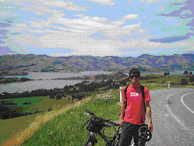
Looks like Window's default background - Between Westbury and Deloraine

Back to the saddle, from Westbury to today's goal, Deloraine was flat short ride. I made it to Deloraine at 3.00pm.


Some sort of art? - Entrance of Deloraine

Deloraine is a pretty riverside town with the population of 5,000. Along the main strip there were quiet boutique restaurants and cafes. I really liked this town because this nice cafe feeling with beautiful river, which was swimmable, and the town had a full of bits and pieces of arts everywhere in town. The people seemed very friendly (very used to looking after tourists in a good way) as well.


Beautiful Swimmable River (view from my tent) - Deloraine

I pitched my tent in the caravan park, which was right next to the river. Of course I swam in the river as it was particularly hot day for Tasmaia (probably over 30 c). I met another cycle tourist at this camp site. His name was Mikko from Philippines. He just arrived in Tasmania from Melbourne by ship, Spirit of Tasmania and rode to Deloraine (49km). We had dinner at on the main street's snack bar, then, bought some beer (Boag's Draft, Launceston's Premium Beer) at the bottle shop, walked back to the campsite and had a small party right front of the river with many ducks.

It was a good night. Everything was just right.

Today's Route

View Larger Map

Wednesday 27 January 2010

Day 5 Port St Helens to Lilydale

Date: 10/JAN/2010
Route:St Helens - Derby - Scottsdale - Lilydale
Distance: 145km
Accident: 0
Puncture: 0
Weather: Cloudy then fine
Accommodation: Lilydale Falls Reserve (Free / Toilets and Water Falls)

This morning I was up at 5.3oish and had a slow breakfast as there was a TV in the campers' kitchen and it was showing 80's pop music.

As soon as I left St Helens many hills were waiting for me from moderate hills, normal hills, extremely steep hills, short hills to long hills. So today was the day of hills, I would say. Therefore It was a challenging terrain but the scenery was amazing as well.


Feeling like the Jurassic Period - Weldborough Pass Rainforest Walk


Like snow - Near Derby


Fish in the wood - Derby

In Derby I met a group of cycle tourists. They are from Germany, France and Australia. One of the guys were travelling with $175 bike from K-mart so the peddles and seat post was already bent with this rolling hills. That was legend, mate.

That was the major event of today. Otherwise I was riding, riding and riding for whole day from 7.00am to 5.30pm as I wanted to go as further as possible.

The campsite didn't have a shower so I took a natural shower under a fall. I felt like very wild today. Like the Man vs Wild. :)

You have to do this to survive - Lilydale Falls

All good but very tired today. My legs need good rest tonight. Good night.


Tea Time


Today's Route

View Larger Map

Tuesday 26 January 2010

Day 4 Bicheno to St Helens

Date: 09/JAN/2010
Route:Bicheno - St Helens - Binalong Bay - Bay of Fires - St Helens
Distance: 116.90km
Accident: 0
Puncture: 0
Weather: Fine then cloudy and windy
Accommodation:BIG4 St Helens Caravan Park ($33 / Unpowered Site)

Started the day with the farewell for James, today's goal was Tassie's most visited natural attraction Bay of Fires where Tasmania's best beaches are. The ride was smooth as I got a reasonable tail wind for the first 30 to 40km. Terrain was basically flat with oceanic and forestry views. There was hardly no traffic!


Ragged Mountain - A3 HWY

I arrived at today's bed, St Helens at 11.30am. This caravan park, BIG3 was extremely expensive ($33/ Camp Site). Well, its a well facilitatd caravan park with new kitchen, clean bathroom and plenty of kids playing ground but I thought they are too profit oriented. It's not my taste, I like more wild places.


St Helens

Anyway, thinking this sort of thing I piched the tent, left all the heavy stuff in the tent, I went to check out the best beaches in Tassie. Bay of Fires was about 12km north east of St Helens. The beachs were massive and beautiful, but I realised one thing. Although there are beautiful beaches and a quiet a few number of tourists here but why no one is swimming in the beach?

I was expecting to swim here so jumped in the beach. I immediately realised why people don't swim there. The water was FREEEEEEEEZING. Couldn't hardly stay in the water for few minutes.

Its a not swimming place, nice viewing beaches.


Beautiful Sandy Beach - Bay of Fires


Like some resort island - Binalong Bay
Then, I went back to St Helens, did shopping, had some snack, and now I am writing this diary.

Another day was over, it seems to be going to be a hard day tomorrow with a lot of climbing so I will do a lot of stretching tonight and go to bed early enough. Good night.

Today's Route

View Larger Map

Monday 25 January 2010

Day 3 Triabunna to Bicheno

Date: 08/JAN/2010
Route:Triabunna - Swansea - Bicheno
Distance: 99km
Accident: 0
Puncture: 0
Weather: Cloudy
Accommodation: Bicheno East Coast Holiday Park ($10 / Unpowered Site)

I woke up with feeling a need to urinate at 5.30am. Thanks to the feeling, I could have a head start this morning. I left the caravan park at just after 6.00am.

The first half ride for today was supposed to be easy as as there was no hills and very few traffic. But it was not that easy as I got a strong head wind constantly for the first 30km. It was actually pretty hard.

On the way I stopped by a beachfront free campsite, Mayfield Camp Site between Swansea and Triabunna. Although there was no shower facility, it looked like a really nice spot to stay couple of days. (and it's free!)

Apparently, there are a number of free (or very cheap) campsites around Tasmania and they are managed by the state and normally located in a remote area. As cycle tourist its best to have shops near by but these campsites have perfect location to enjoy the nature, so I want to try some during this trip.

After arriving in Swansea, I saw a guy with a bike. It must be a cycle tourist! Yes he was. I was a bit excited as it was my first time to talk other cycle tourist.

We had coffee and had a chat. His name was James from Canada. He was riding from Hobart as he got some time to spare in Australia. What's a nice idea. He was also heading to the north to Bicheno.

As I was heading north but different way, I suggested him a my plan for today, to take a private boat service from the end of Nine Mile Beach to near Coles Bay, which is the closest town to Freycinet National Park, one of Tasmania's most famous National Park with its pristine coastline and walking tracks. In this way, we could save 50km easily and able to see and walk the National Park in the same day. He liked the idea and we decided to take a ferry.

But, that day the ferry was not operating due to the wind. (or due to trublesomeness.. who knows) So the plan wouldn't work as bikes cant cross the sea.

oops, travelling is a full of uncertintity.

So we gave up the National Park and headed Bicheno, another sleepy coastal side holiday town.
The first 25km was flat kind of boring road with few traffic with tail winds. After 25km all the suddent the scenery got into beauftiful forest.


Forrest Opens - A3 HWY

Just before Bicheno I stpped at strawberry farm to have its strawberrry sorbet. It was a great treat.


Strawberry Treat - Strawberry Farm Near Bicheno

Finally I got to Bicheno at 1.15pm. It is always best to get to a day's destiation earlier, because I can look around the area. I went to see the town's attractions such as ragged beaches, blow holes, and a swimming beach. Unfortunately, the weather of the day wasn't perfect to enjoy all these places so it was all right for me. But its always fun to explore new places.

Blow Hole - Bicheno

This night, James and I went to a local restaurant for dinner. Great to have a company for dinner and decent dinner. Had a good night and went to bed fairly late 8.30pm.

Today's Route

View Larger Map

Sunday 24 January 2010

Day 2 Port Arthur to Triabunna

Date: 07/JAN/2010
Route: Port Arthur - Copping - Wielangta Forest Drive - Orford - Triabunna
Distance: 96km
Accident: 0
Puncture: 0
Weather: Fine (Beautiful!)
Accommodation: Tribunna Cabin & Caravan Park ($15 / Unpowered Site)
Good timing - Near Eaglehawk Neck

Another long day ride! I left Port Auther at late time of 7.30am. My alarm clock didn't work this morning plus the wine from the last night made me overslept for an hour.

The first 30 - 40 km to Copping was very smooth not as hard as yesterday even I was going back the same way.


The first stop for today was Copping, a small town end of two peninsulas. I had a extra large chicken burger for breakfast (yum!). When I was eating it, one friendly local cobber* talked to me as he saw my bike in front of the milk bar**.

*a cobber: a man
**a milk bar:a small shop selling milk and other basic provisions

He told me that the road which I was approaching was partly closed as the bridge was down. Down? sounds pretty wild. but he said with grin "you'll be fine, you can carry your bike and cross the river'. and he actually recommended to go ahead on that road as the road was really scenic way and nicely compressed dirt road. So I felt a bit relieved.

If I conclude what happened next, the next 35km was hell hard. As it mentioned on the map it was gravel. It was good at the beginning as the road was nicely compressed but as I get into the forest deeper and deeper the road become more and more bumpy and hilly. It wasn't gravel in the end I guess IT WAS ROCKY. But as the road was partly closed, there were hardly any cars on the way for this 35km and it was really scenic road as well with forest ocean views.


Scenic but Hard - Wielangta Forest Drive

Having ridden the long gravel (rocky) road, the front carrier has got damaged a bit (but easily fixable) but nothing went wrong with the bike because it was a bit of challenge as I didn't set up my bike for gravel roads. Good.


Beautiful Coastlines - Near Orford

From the end of the gravel road there was a small sleepy seaside town of Orford. Form there to today's destination, Tribabunna was easy flat ride of 7km.

Got to a caravan park here and writing this blog. Oh, its 7.30 I have to go to bed soon!

Today's Route

View Larger Map